What is this Project about?

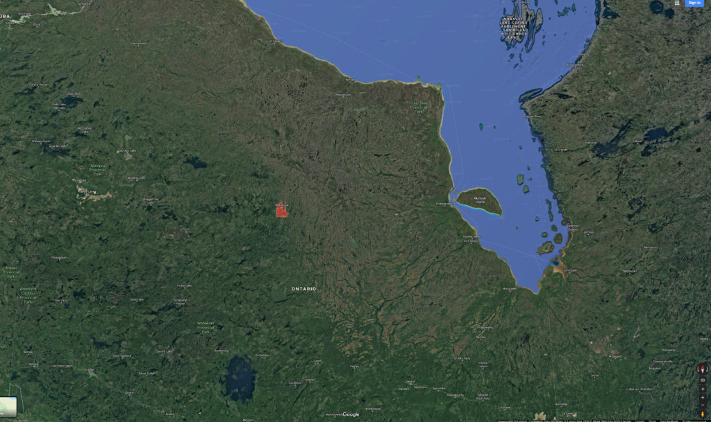
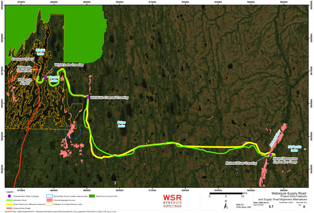
This project is a Webequie First Nation-led environmental assessment and preliminary engineering study of a proposed all-season road connecting Webequie airport with the existing mineral exploration activities and proposed mine developments in the McFaulds Lake area. The purposes of the all-season road are: (1) to facilitate the movement of materials, supplies and people; (2) to provide employment and other economic development opportunities to WFN community members; and (3) to provide experience and training opportunities for youth to help encourage pursuit of additional skills through post-secondary education.

Environmental Assessment (EA) and Impact Statement (IS) Phases

  1. 1
    EA/IA Engagement and Consultation

    There are three rounds of consultation during the EA Phase, consisting of Indigenous community meetings and/or Chief and Council meetings, as well as open houses.

  2. 2
    Alternatives Development and Evaluation

    This will be conducted during Rounds 1 and 2 of Engagement and Consultation. Consultation will be on alternatives developed, including criteria and indicators for evaluation, followed by the comparative evaluation for routing alternatives and supportive infrastructure.

  3. 3
    Preliminary Engineering Design

    Completion of Interim Preliminary Design Report and design drawings, followed by final design drawings, design report and construction cost estimate.

  4. 4
    Environmental Assessment Report (EAR) and Impact Statement (IS)

    Preparation and completion of interim and draft environmental assessment and impact statement reports.

The Terms of Reference (ToR) describes how the EA will be prepared, what will be studied, and how Indigenous communities, the public, and government will be consulted during the EA.

How will communities be engaged?

The study includes community engagement during the Environmental Assessment (EA) Terms of Reference (ToR) and EA stages of the project. 

Community engagement will include interviews, small group sessions and workshops with community members to talk about road location alternatives, areas of importance to the communities being consulted, and studies being undertaken.

VIDEO: Fly over the project area using our fly-through video.  You will travel west towards Webequie from the road’s end just west of McFaulds Lake.  The yellow markers are spaced every 50 m and can be used to identify locations if viewers want to note features our project team should be aware of as part of the environmental assessment work.

Proposed Project Location

Alternative Alignments
Webequie Community Input

Key community-based factors considered:

  • Caribou Habitat
  • Culturally significant features (natural or built)
  • Areas used intensively for traditional activities
  • Fish spawning areas
  • Seasonal hunting areas
  • Moose mating areas
  • Community source of spring water
Supply Road Alignment Alternatives
Other Factors

Key engineering and geotechnical factors considered:

  • Type of terrain/land
  • Number of water crossings
  • Soil types
  • Proximity to potential aggregate (gravel and rock) sources

The environmental assessment for the Supply Road Project will follow federal, provincial and Webequie First Nation regulations and protocols. Please visit our process page.

    Etiam magna arcu, ullamcorper ut pulvinar et, ornare sit amet ligula. Aliquam vitae bibendum lorem. Cras id dui lectus. Pellentesque nec felis tristique urna lacinia sollicitudin ac ac ex. Maecenas mattis faucibus condimentum. Curabitur imperdiet felis at est posuere bibendum. Sed quis nulla tellus.

    ADDRESS

    63739 street lorem ipsum City, Country

    PHONE

    +12 (0) 345 678 9

    EMAIL

    info@company.com